The U.S. Department of Defense developed GPS, or Global Positioning Systems, which are satellite-based navigation systems used for military purposes. But they are more familiar to us as the navigational systems used by cars and mobile phones. Whether it is a marine, mobile, or an auto unit, a GPS device determines your location by triangulating data from multiple orbiting satellite signals.
Beyond the primary, active satellites, additional spares are positioned in orbit to be activated if a “healthy” satellite malfunctions. By measuring time-of-flight differences across at least three satellite signals, the receiver can calculate its location based on the known, precise positions of those satellites. They are moving through space at over 186,000 MPH. The GPS receiver can identify its exact position anywhere on the Earth.
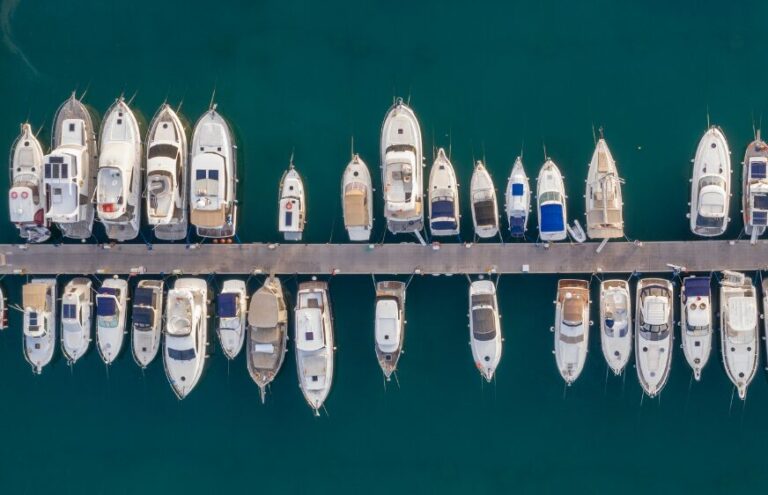
Why GPS Is Necessary For Boat Navigation
Modern chartplotters are affordable and necessary on almost any vessel, offering crucial real-time tracking, hazard avoidance, and navigational data that make coastal boating much safer. Always be prepared for the unexpected, whether it’s blinding fog or a broken-down car that keeps you out past dark. During such times, you’ll be glad you have GPS.
Now, think that your phone already has GPS, so why do you need one for the boat? It’s a good question, mainly because you can use various boating apps to more or less turn your phone into a mini-chartplotter. Mobiles have various disadvantages:
- These units lack the ruggedness needed to withstand heavy spray or falling from the dash onto a hard fiberglass surface.
- Most add-on mounts are not durable enough to handle the harsh vibrations and shocks of a running vessel, as they are not securely fixed to the helm.
- The batteries may run out more quickly than anticipated, and many boaters travel outside of cell coverage areas regularly.
- The GPS plotter enables you to select either the shortest route or the safest route, which leads to more efficient travel while reducing both fuel consumption and travel time.
Smartphone apps make an excellent, portable secondary navigational tool, but they lack the reliability, durability, and robust power supply required for primary, offshore navigation.
Different Types Of GPS Systems Used On Boats
Since boaters have different needs and budgets, GPS navigation comes in several forms. The GPS on boats operates through multiple options, which include both dedicated hardware and mobile applications that users can operate from their personal devices.
1. Anchor Alarm
A key safety tool for boaters is the GPS anchor alarm, which triggers a warning if the boat moves outside a pre-set perimeter. Set a digital geofence around your vessel while anchored. If the anchor drags or the rode breaks, the GPS triggers an alarm upon boundary breach.
2. Security System
Today’s smart systems enable you to track your boat’s position from anywhere via your phone, acting as an effective anti-theft security solution. You can set that geofence up around your boat, and if someone tries to steal it, you’ll get a text alarm as soon as it moves out of position.
3. Additional Features
Connecting your GPS to other onboard electronics unlocks additional, advanced functionality. They are as follows:
- The system provides steering input to the autopilot and displays environmental data overlays.
- Crucially. Connect your GPS to your VHF radio to enable automatic position. When your VHF receives position data, you can use it for DSC (digital selective calling). Do this, and if you ever need to call the Coast Guard, your exact position will be transmitted along with your call.
The Rise of the Need for GPS Apps
While traditional GPS units remain reliable, many boaters are now shifting toward app-based navigation solutions. The way boaters navigate their routes has undergone significant changes during the past several years. The reason for this is that the technology enables all users to access electronic navigation systems without traditional barriers or complexity.
Here’s what’s driving the trend:
No Hardware Required
GPS apps transform standard smartphones and tablets into complete marine GPS systems. The system provides boat owners with major savings since they can use their existing equipment without needing to purchase costly hardware or install mounting systems or complete electrical installations.
Ease of Use
App interfaces have been created to deliver an intuitive experience that allows first-time boaters to access the system. The system provides a user-friendly interface that allows users to operate the application without needing to learn complicated navigation systems or read detailed documentation.
Real-Time Updates
Unlike older hardware that may require manual map updates, apps often receive real-time chart and data updates, including tides and weather. This is all done without any extra effort on the users’ part.
Portability
Given that it belongs to a mobile, navigation follows you, whatever the boat is: whether it is a rented one, a friend’s boat, or your own boat.
Growing Community and Data Sharing
Many applications use user-created waypoints and user-reported hazards to enhance their navigation features through real-world knowledge, which other boaters have provided.
The new technology enables all users with smartphones to access boating navigation systems, which used to require advanced technical skills for operation.
Main Features to Look For
Regardless of whether you choose a dedicated unit or an app-based solution, certain features are essential for safe navigation. Be it a dedicated GPS device or an app, certain features can create a significant difference in safe and efficient navigation.
Real-Time GPS Positioning
Tracking its precise location through movement in space forms the core of any system.
Interactive Nautical Charts
Marine charts with depth shading, marine symbols, and hazard markings help read the compass at a glance.
Waypoint and Route Planning
If key locations like launch points, anchorages, or hazards are logged, navigating becomes easier and more consistent.
Weather and Tide Integration
Your chart allows you to see tide levels, wind speeds, and forecasted conditions, which in turn provides you with exact information and paves the way for decision-making throughout your trip.
Offline Chart Access
The offline charts app is useful, especially in areas with no phone networks, where Internet-based apps cannot be used.
Community Data and Shared POI
Some apps enable users to share points of interest, hazards, anchorages, and boat ramps, which creates a shared navigation system. The features of the system help you to travel through your journey in a safe, effective, and pleasant way.
How to use Marine GPS for Boating
The more satellites your receiver tracks, the more accurate its calculated position. The accuracy depends on several factors, ranging from environmental conditions to receiver quality. When many other satellites are in view, a common GPS receiver with dual channels can get significantly more accurate.
- Once you start moving, the GPS keeps updating where you are and how fast you are going, and where you are headed.
- GPS allows you to save specific spots on a map, which are called waypoints. For boaters, this tool saves specific coordinates for navigation hazards or prime fishing locations.
- Build a complete trip by linking together several intermediate locations.
While it is still possible to view your position in latitude and longitude on boating GPS systems, most modern marine GPS units employ a digital chart to indicate your location, similar to how a cell phone’s street map displays your position.
A “chartplotter” or “GPS/chartplotter” is a GPS that has the ability to display charts. Additionally, the scope of digital charts has expanded significantly in recent years, and they are now more accurate and detailed. By comparing your GPS position with depth soundings from your fishfinder, many contemporary chartplotters also let you enhance the digital charts you view in real time while you navigate your boat.
Marine Navigation with GPS
While GPS is the easiest way to navigate, sailors often make the mistake of relying on graphical, moving-map displays instead of using the more accurate numerical steering data. You can navigate by aligning your vessel’s digital icon on the GPS screen with the desired heading shown on the electronic chart.
For significantly higher steering precision, utilize a dedicated digital steering display. This interface provides real-time data, including your target bearing, current heading, and directional cues, guiding you to correct your course to port or starboard to maintain the most direct path.
Benefits of App-Based GPS vs Traditional GPS
The advantages of app-based GPS navigation are becoming clear for many boaters:
Affordable Navigation
Applications cancel out high upfront costs that come with GPS-based devices, like hardware or installation costs, thus benefiting casual sailors on occasion.
Instant Updates
Changes in display configurations, tide forecasts, and weather predictions do not need to be manually synchronized under groundbreaking technology, unlike traditional installations and systems.
Portability Across Boats
Each of your boats and every trip may use only one device. Why bother about installing and recertifying somewhat costly.
User-Friendly Interface
The ordinary users are the target audience for app interfaces that are mostly based on simple menus and easy-on-the-hand, touchscreen ergonomics.
Community Insights
The navigation experience becomes better through shared data from boaters, which includes information about hazards and popular anchorages.
Even with advanced GPS technology, responsible navigation requires preparation and good boating habits.
Tips and Solutions
When using modern sources for navigation, one should remember the elements of safety and preparedness:
Have a Backup
Technology can fail. Therefore, it is advisable to use a second navigation channel, such as a chart or a handheld GPS on a boat, to aid navigation.
Watch Your Power
Prevent your device from draining your battery, which makes portable battery packs very beneficial while on a trip.
Check Conditions Ahead
Checking tide tables and predicting the weather just before leaving the dock is a necessity, as it can save you from unexpected issues mid-trip.
Update Your Charts
You need to download the most recent chart versions before your departure if you plan to use offline charts. Your navigation will improve through safer and smarter routes when you combine technological tools with effective boating practices.
Conclusion
Choosing the right GPS solution allows boaters to navigate with confidence, safety, and freedom, no matter where the water takes them. With a reliable navigation system in place, water travel becomes smoother, faster, calmer, and less stressful. Whether you prefer traditional marine GPS units or modern app-based solutions, there is a reliable option for every boater. A GPS on your boat offers three key benefits: accurate navigation, greater confidence at the helm, and peace of mind during both lake and coastal journeys. Thanks to ongoing technological advancements, boating has become more accessible, allowing everyone to operate their vessels safely and efficiently on the water.